Community Forest Resource (CFR) Potential Mapping is a methodology to identify the villages and estimate the minimum forest areas that communities are likely to claim under India’s Forest Rights Act (FRA) of 2006.
This establishes a baseline estimate against which villages and areas currently recognized under CFR rights may be compared to evaluate progress.
It empowers community members, community workers, CSO partners, and state agencies, to identify areas where there are gaps in implementation of FRA and the areas where claim-making can be initiated.
When represented in a publicly browsable WebGIS form, it also enables grassroots activists and officials to understand the context of each village where a claim may be made.
How is CFR Potential Mapping estimated?
We use land-use information in Census Village Amenities Tables and the corresponding village boundary maps to identify villages and estimate potential areas using two criteria:
Villages which contain more than 10 ha of ‘forest’ land (as per Census data) within their administrative boundary. The area of such ‘forest’ land constitutes the first part of the area estimate.
Villages that are adjacent to forest patches outside village administrative boundaries. In such cases, we assume that village customary boundaries will extend up to at least 2 km into these forest patches. This thumb-rule is used to generate the second part of the area estimate.
By combining these village lists and areas, a comprehensive map of CFR-eligible villages and potential areas under CFR is created.
What are the data sources and techniques used in generating these estimates?
The village lists and land-use data come from Census 2011 village amenities datasets.
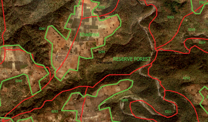
The village boundary maps (vector files) are based on maps generated by various state agencies, to which the Census datasets have been linked by us.
GIS (Geographic Information System) techniques are used to a) identify villages adjacent to forest patches that lie outside village administrative boundaries, and b) to generate the 2 km buffer to estimate the potential CFR area that may be claimed in such forest patches.
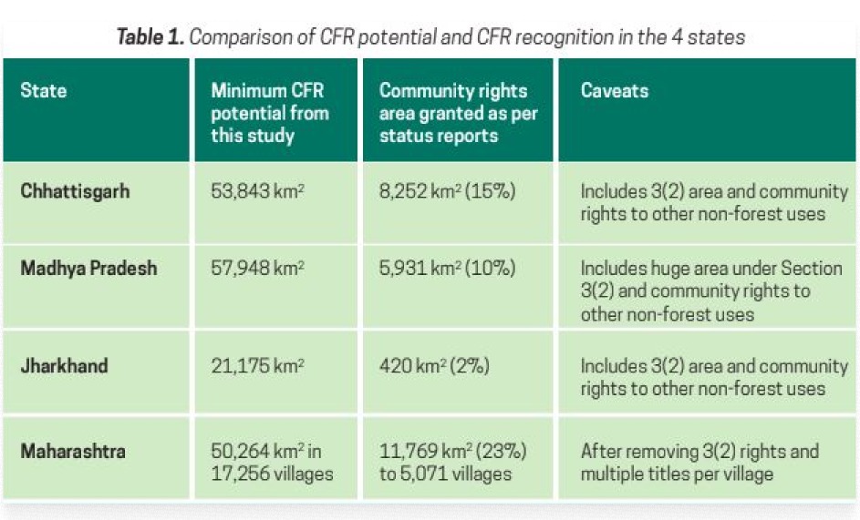
Results: Estimated CFR Potential in Central Indian States
Our initial study, published in 2020, estimated the CFR potential in four central Indian states: Maharashtra, Madhya Pradesh, Chhattisgarh, and Jharkhand.
In May 2025, we updated the results for Chhattisgarh and Madhya Pradesh, by correcting village landuse data using forest compartment maps.
In May 2025, we also published results for Odisha. The updated set of CFR potential estimates for 5 states are presented below and compared to information the CFR recognition available to us [published in Lele and Sahu, 2025]
The lists of CFR potential villages are published here:
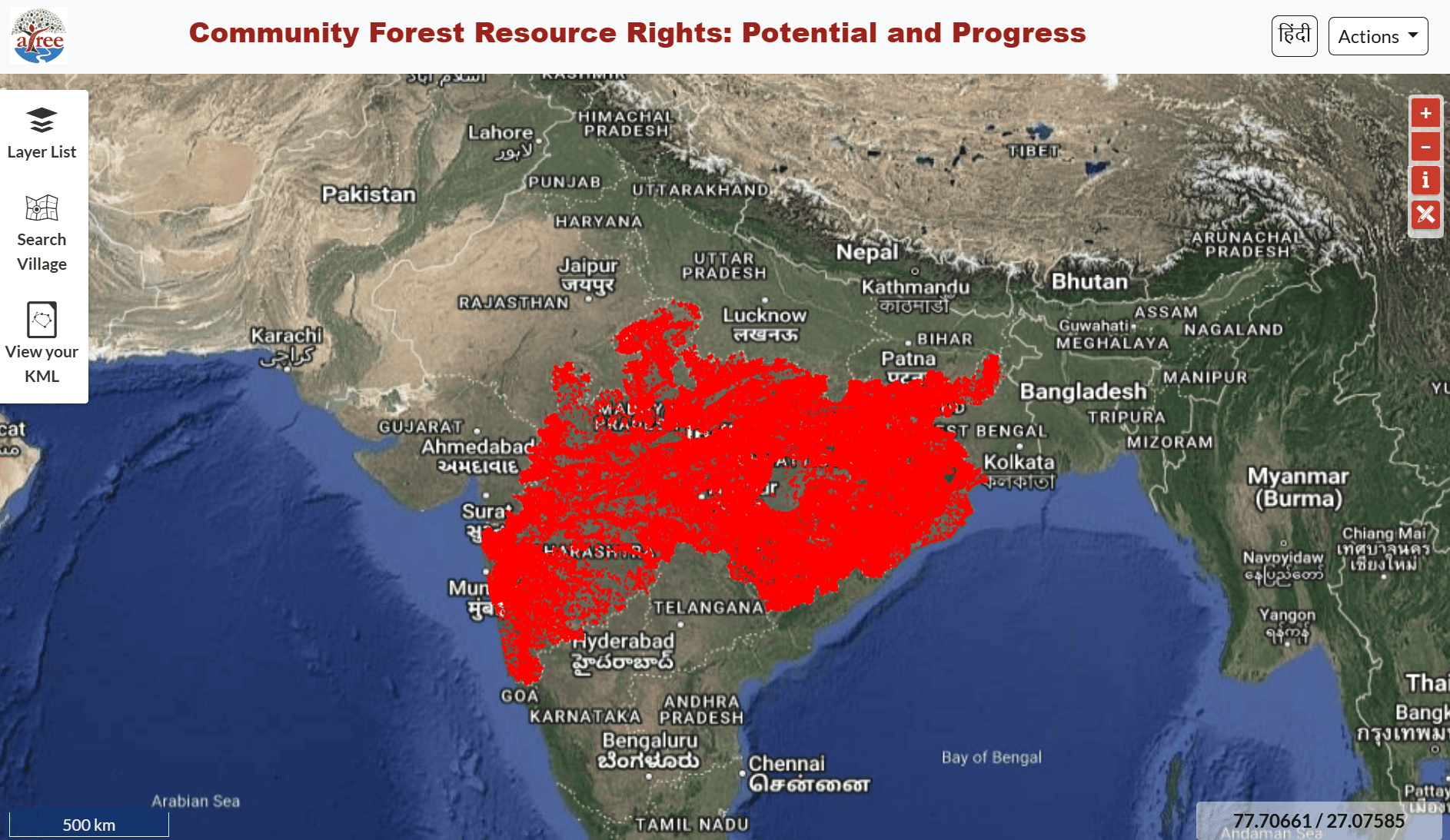
The results of our mapping exercise are presented in a publicly browsable WebGIS, where the ‘layers’ containing village and forest compartment boundaries are overlaid on high resolution satellite images and CFR potential villages are displayed as an additional layer.
To facilitate grassroots users, the WebGIS is available in both English and Hindi.
The WebGIS has a village search tool, a kml overlay tool, an area/distance measurement tool, and an information tool that provides useful secondary data for the polygon that one clicks on.