How do we as researchers help in the implementation of a progressive but complex piece of nature resource legislation? The implementation of the Forest Rights Act of 2006, especially its community rights provisions, has raised this question for us repeatedly. Typically, research tends to be post-facto: showing what went wrong with Joint Forest Management, or throwing light on how implementation could have been better in the case of the FRA. Supporting ongoing implementation efforts presents a different challenge: interfacing our somewhat academic understanding with the particular ground realities of state administration and people’s priorities. Our new project on “Training, Capacity-Building and Decision Support for CFR Rights Recognition and Management in Bastar district”, where the Bastar district administration invited us to provide such support, has thrown us this challenge. But we are heartened to find that our specialised knowledge can indeed make a difference!
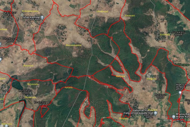
A map of the revenue boundary of Jharumargaon village (and neighbouring villages) in Bakawand block, overlaid on Google Earth satellite view